I Like Maps
I use Find My often
Last time I decided on a new, very detailed direction for one of my first visionOS projects. This new project will adhere to the following imperatives:
- The concept must have some portion runnable on visionOS
- The concept must use volumes as its primary visionOS interface element
- The concept must interest me
The door is pretty much wide open.
So, What Do I Like?
I like maps! My first startup 8 years ago was effectively a map of geo-fenced chatrooms. I jumped on the iMessage app hype train 7 years ago and the first thing I built was an app to quickly share your location with friends in iMessage. Being a lifelong gamer, and a huge fan of certain multiplayer shooter franchises, I know one of the most crucial things to learn when starting a new game is the layout of the different maps. I enjoy figuring out where everything is on a new map and exploring its secrets.
Growing up, I loved making dioramas – which are quasi-related to maps. Dioramas are generally a very localized, zoomed-in, 3D version of a map. Oftentimes, dioramas are looking to paint a more intricate, intimate picture of a place compared to maps. Sometimes, dioramas are trying to relay a story. Dioramas and 3D maps also seem quite conducive to fitting in a visionOS volume, so let's continue exploring this thread.
When building personal projects, I have a tendency to focus on an extremely niche problem or product that appeals to very few people. That's fine with me, but I want to take a different approach this time around. This time I'll start by thinking about how I use apps made by Apple. Since many apps made by Apple come pre-installed on iOS, such apps are installed on over a billion iPhones out there. Given I'm focusing on maps, let's talk about one of the two Apple iOS apps focused exclusively on maps: Find My.
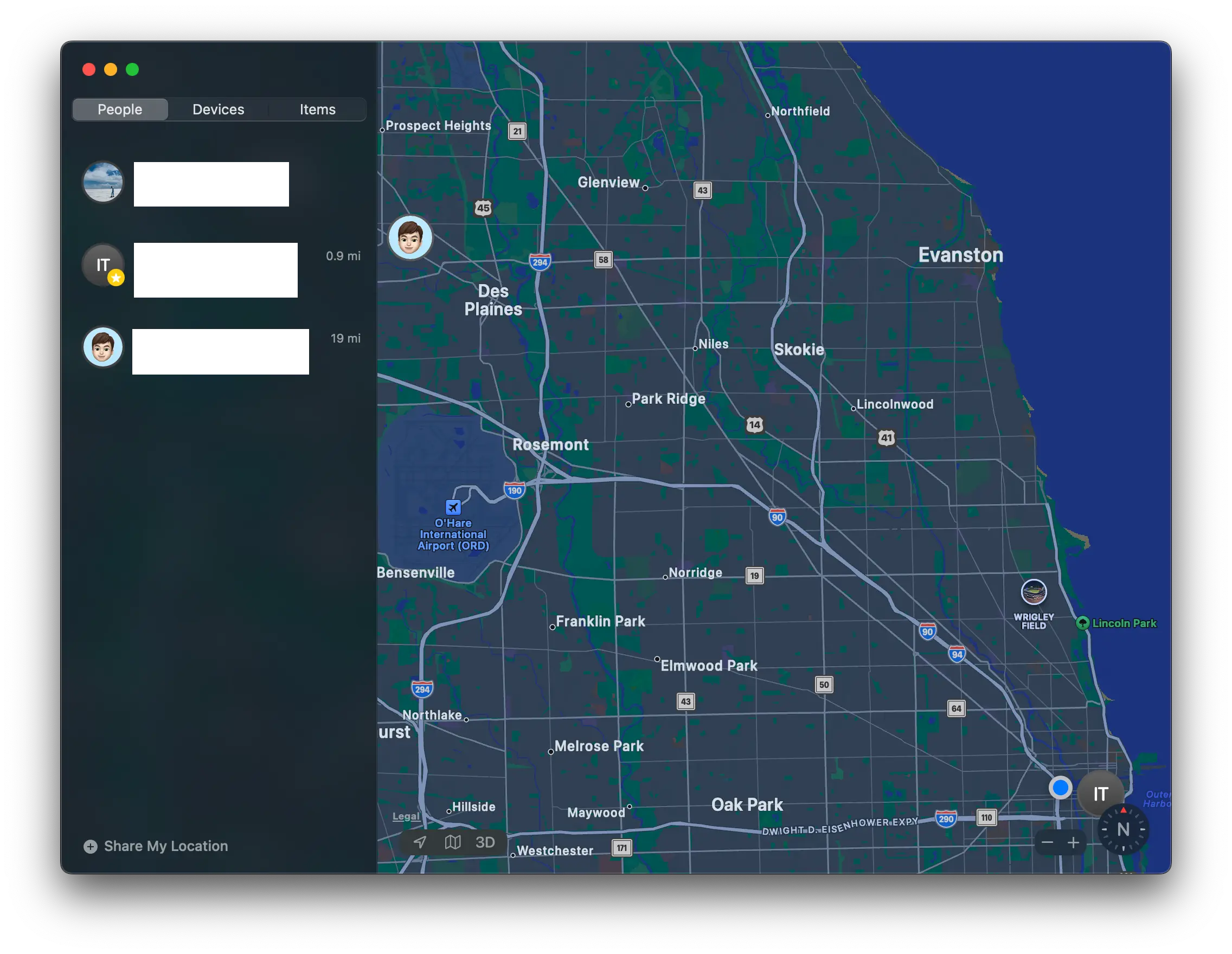
I Love Find My
I use it a couple times a week for five seconds at a time, and I primarily use it for one specific purpose. I've had dogs all my life and frequently dogs will get used to a schedule. They'll know the rough timeframe when someone is due to come home. When that time of the day arrives they'll look out the window. And wait. And anticipate. That's how I use Find My. I'm the dog in this scenario and instead of looking out the window I pop open Find My to see if my wife is almost home. The app is glanceable and legible: I use the app for a moment and I get all the information I need. The app gives me important real-time, positional information.
What intrigues me about this use of Find My is that it's a cartographic representation of very important people. But trying to make some type of volumetric, visionOS version of today's Find My doesn't sound promising. Viewing this map of VIPs in 3D doesn't add much to the experience – the map is too zoomed-out, too low-fidelity for 3D models and renderings to provide much additional value or noticeable eye candy.
What if We Could Zoom In on the Find My Map?
But what if we could zoom in further on specific hotspots? For many people I think there would be two main categories of such "hotspots" that represent various types of VIPs (very important people, pets, and places):
- Home + family
- Work + coworkers
Let's focus on that first place for now.
What would it look like to build an app that zoomed in on the map to provide a volumetric, 3D representation of our home updated with real-time information?
Let's (try and) find out.